Via Ferrata des Perrons
-
19 Via Ferrata des Perrons, Venosc, Les 2 Alpes, Isère, France
Via Ferrata des Perrons, Venosc
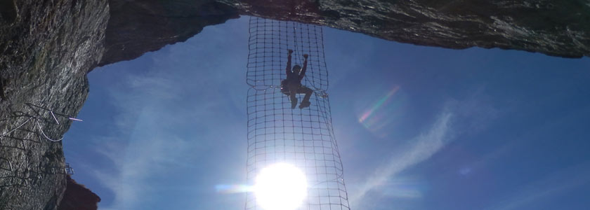
Passerelle Pont de singe Echelle Tyrolienne 0 0 0 0 Caractéristiques
Cette via ferrata est assez longue avec des passages athlétiques. Beaucoup de contacts avec les rochers, presque de l'escalade.
Très beaux panorama sur les Écrins et vue sur VenoscMontée en télécabine possible.
 Conseils ViaFerrata
Partir le tôt le matin sinon il risque de faire chaud. Prendre de l'eau et du miam.
Comme il y a pas mal de contacts avec les rochers, certains utilisent le câble pour se tracter. Dans ce cas, prends des gants pour éviter les blessures aux mains.
Tu peux prendre ton VTT avec toi dans les remontées mécaniques et faire la descente à vélo pour une journée sportive.
Cotation
Physique 2 Gaz 3 Type Montagne: 2 Technique 1 Evaluation Difficile Information
Office du Tourisme de Venosc
 Longueur & Altitudes
Parking: 1'000 m
Départ Via Ferrata: 1'250 m,
Sommet Via Ferrata 1'750 m
Denivelé: 500 m
Longueur : 500 mCoordonnée GPS
Période
Mai à octobre, selon la neige
Horaire
Accès : 40 min à 1 heure
Viaferrata : 1h30 à 2h00
Retour: 30 min par les alpages pour rejoindre les 2 Alpes + 1h pour redescendre sur Venosc par le sentier ou 10 min par le télécabine Par la route
De Grenoble, prends Bourg d’Oisans et ensuite Venosc, St-Christophe et La Bérarde. A 65 km de Grenoble, tu devrais normalement trouver Venosc. Parque ta titine au départ du télécabine en direction des 2 Alpes. Tu peux prendre le sentier qui mène à la via ferrata (compte 40 minutes) ou le télécabine qui est la version un peu moins sport.
 Par le Train
Voir avec la SNCF pour les bus et train.

 Accès
AccèsDe la télécabine, prends le chemin à gauche et garde un oeil sur les indications pour y arriver.
Via Ferrata
Dès le début de la via ferrata le vide se fait sentir. Les 100 premiers mètres sont raides avant que tu n’arrives dans une vire herbeuse pour un peu de repos.
La deuxième partie est un peu moins verticale. Ensuite, tu découvres de nouvelles vires avec un épicéa isolé qui offre un endroit idéal pour la pose casse-croûte.
La dernière partie est peu raide et simple.
Retour
Par le télécabine, ou tu suis le sentier vers le nord ouest qui rejoint les Deux Alpes. Compte 45 minutes à 1 h avec tes jambes et moins si tu as pris ton VT pour la descente.
 Ou dormir
Azimut: Hébergement, restauration, guide, une excellente adresse.
Gîte de Montbrison: ancienne ferme reconstruite avec du goût et beaucoup de talent..
Gîte de la Tête d'Aval à Vallouise situé dans le vieux village.Photos
par Sarah Ben, Youtube
Tu as une vidéo à proposer, envoie-nous le liens -
19e Via Ferrata des Perrons, Venosc, Les 2 Alpes, Isère, France
Via Ferrata des Perrons, Venosc, Les 2 Alpes, Isère

Footbridge Monkey Bridge Ladder Zipline 0 0 0 0 Features
This via ferrata is fairly long and has some demanding sections. Lots of contact with the rock, it's almost rock climbing.
Beautiful panorama of the Écrins and a view on Venosc.
It's possible to go up with a gondola.
 ViaFerrata Tips and Tricks
Leave early in the morning otherwise it will be too hot. Bring water and munchies.
As there is a lot of contact with the rock, some people use the cable to pull themselves along. If you will do this bring gloves to avoid hurting your hands.
You can also bring your MTB with you in the gondola and then ride back down for a truly sport-filled day.
Grade
Strength 2 Dizziness 3 Type Mountain: 2 Technique 1 Evaluation Difficult Information
 Length & Altitudes
Parking lot: 1,000 m
Start of the Via Ferrata: 1,250 m
End of the Via Ferrata: 1,750 m
Elevation gain: 500 m
Length: 500 mTime of Year
May to October depending on snow
Timing
Access : 40 min to 1 hour
Viaferrata : 1h30 to 2h00
Way back: 30 min via the alpine pastures to get back to the "2 Alpes" + 1h to go down to Venosc by the trail or 10 min with the gondola By Car
From Grenoble, take Bourg d'Oisans and then Venosc, St-Christophe, and La Bérade. 65km from Grenoble you should find Venosc. Park your ride at the bottom of the gondola which goes up to the "2 Alpes." You can take the trail that goes to the via ferrata (about 40 minutes) or take the less demanding option- the gondola.
 By Train
Check with the SNCF for buses and trains.

 Access
From the gondola, take the trail on the left and keep an eye out for signs marking the way.
Via Ferrata
The void makes itself felt right from the start of the via ferrata. The first 100 meters are steep and then you get to a grassy ledge where you can rest a bit.
The second section is a bit less vertical. You will discover some new ledges where an isolated spruce presents itself for the perfect snack break.
The last part is not very steep and quite simple.
Way Back
With the gondola, or follow the trail that goes northwest and connects the "Deux Alpes." It takes approximately 45 minutes to 1h on foot and less if you brought your MTB.
 Where to Spend the Night
Azimut: Lodging, food, guides, an excellent place.
Gîte de Montbrison: an old farm that was remodelled with good taste and lots of talent...
Gîte de la Tête d'Aval: in Vallouise, located in the old village.Media
par Sarah Ben, Youtube
Tu as une vidéo à proposer, envoie-nous le liens


